Ministry of Natural Resources of Russia launched an interactive map of fighting forest fires
The Ministry of Natural Resources and Ecology of the Russian Federation has developed and launched an interactive forest fire fighting map: http://www.mnr.gov.ru/activity/fire-map/. Thanks to this format, you can get acquainted with the forest fire situation in each region of the country, as well as learn about the measures taken to combat fire in a specific constituent entity of the Russian Federation.
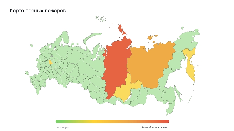
Each region is colored in one of four colors, depending on the forest fire situation. So, the red color means that the subject has the most fires in the forests over the past day, an emergency regime has been introduced, a special fire regime, and a ban on visiting forests. Regions with average and minimum indicators in the number and area of forest fires are marked in orange and yellow. Subjects with a favorable environment, where forest fires are not observed, are highlighted in green.
When choosing a region, you can familiarize yourself with the number of equipment and people involved in extinguishing fires. The map will be updated daily during the fire season.
The methodology for assessing the situation in each of the subjects includes such parameters as the number of fires, the area covered by fire, as well as the introduction of an emergency regime in regions or the region as a whole.
Press service of the Ministry of Natural Resources of Russia